
Originally posted at 9:22 a.m. Updated at 9:49 a.m. with maps. Headline also updated when confirmed the epicenter was in Massachusetts.

BOSTON – Massachusetts was hit with an earthquake this morning, November 8.
Reports have it confirmed at 4.0.
Reports have the earthquake felt all along the east coast from Canada to the mid-Atlantic states.
The time was recorded at 2020-11-08 09:10:07 UTC.
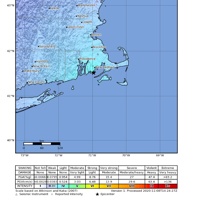
The epicenter was reported at 9 km SSW of Bliss Corner, Massachusetts, according to USGS Earthquake Hazards Program of the U.S. Geological Survey (USGS) is part of the National Earthquake Hazards Reduction Program (NEHRP) led by the National Institute of Standards and Technology (NIST).
Officially the location was at 41.526°N 70.966°W. It registered at 15.1 kilometers.
[broadstreet zone=”59948″]
According to U.S. Geological Survey (USGS), “an earthquake is caused by a sudden slip on a fault. The tectonic plates are always slowly moving, but they get stuck at their edges due to friction. When the stress on the edge overcomes the friction, there is an earthquake that releases energy in waves that travel through the earth’s crust and cause the shaking that we feel.”
According to the U.S. Geological Survey, Massachusetts has recorded over 400 “felt” earthquakes since records began in 1668.
The most recent one in Western Massachusetts wasn’t one that residents could feel, but it was north of Northampton in November of 2012 with a magnitude 1.9.
[broadstreet zone=”59984″]