
Updated with new photo at 7:22 a.m.
***
[broadstreet zone=”59982″]
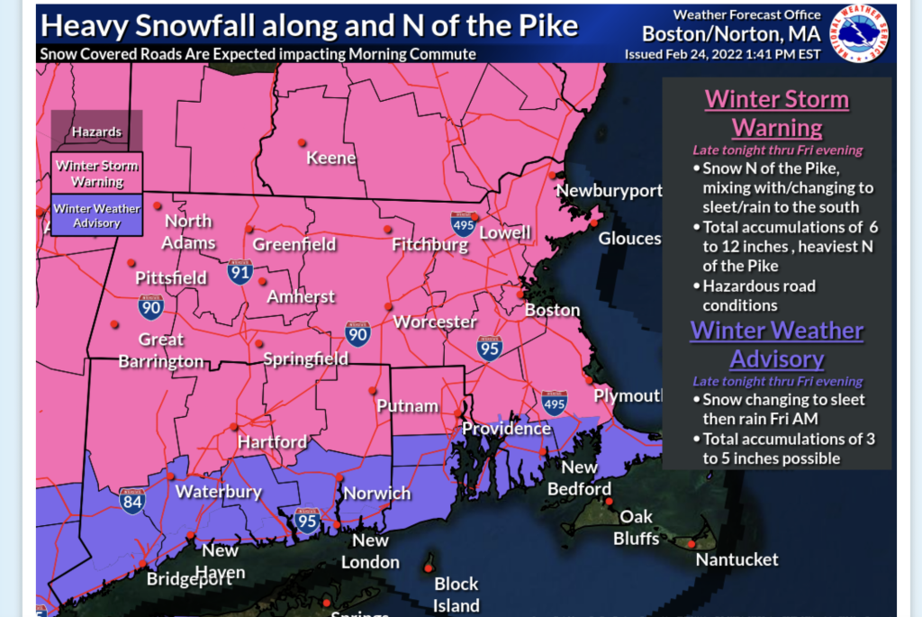
BOSTON – The snowstorm which has been predicted all week is finally here.
The National Weather Service has changed the watch to a warning, which will be in effect until 11:59 p.m. today, February 25.
Heavy snow and some sleet possible too generally near and south of the Massachusetts turnpike. Snow accumulations of 6 to 12 inches.
Travel will be very difficult this morning. 1 to 2 inch per hour snowfall rates will develop early this morning. This will result in a very difficult morning commute.
[broadstreet zone=”54526″]
Snow will change to sleet later this morning near and south of the Massachusetts Turnpike.
.Improving conditions this afternoon especially along the coast as temps rise above freezing and precipitation becomes rather light.
A second round of mainly light snow will result in renewed slippery travel late this afternoon and evening with the focus across central and eastern Massachusetts.
[broadstreet zone=”58610″]