
[broadstreet zone=”59946″]
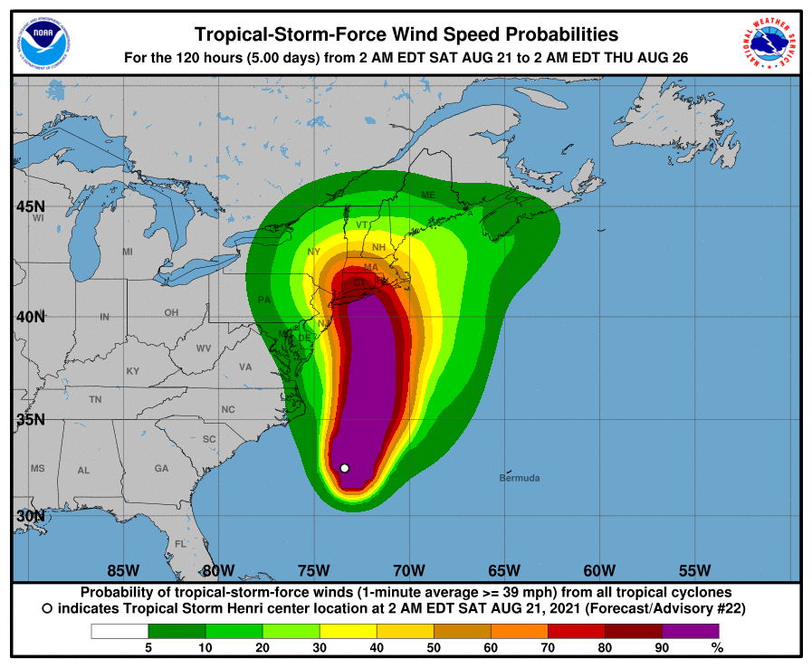
BOSTON – Tropical Storm Henri is forecast to strengthen to a hurricane as it heads northward today, August 21.
Henri is expected to make landfall near eastern Long Island Sunday as either a strong tropical storm or a lower end Category 1 hurricane.
Henri should weaken rapidly as it heads into Connecticut Sunday evening and slowly exits the region Monday, but it will still bring damaging winds, flooding rain, storm surge flooding, and possibly a tornado.
But there is good news, the original tract of the hurricane/tropical storm had it bringing a possible 5-6 inches of rain for MetroWest.
[broadstreet zone=”59982″]
With the tract shifting, those rains are now forecasted for western Massachusetts with MetroWest area expected to get 2-3 inches of rains, about the same we saw earlier this week with Tropical Storm Fred.
Henri is expected to bring up to 8 inches of rain and winds as strong as 50 miles per hour to Massachusetts, so Governor Charlie Baker has urged people to stay inside on Sunday.
Potential damage from the storm across Massachusetts includes:
Roof damage to sturdy buildings, with some having window, door, and garage door failures leading to structural damage.
Many large trees snapped or uprooted.
Some roads impassable from large debris, and more within urban or heavily wooded places.
Power and communications outages.
For hurricane and tropical storm preparedness tips, click here.
[broadstreet zone=”59983″]
Prepare for life-threatening rainfall flooding having possible extensive impacts across western Massachusetts. Major rainfall flooding may prompt many evacuations and rescues.
Rivers and tributaries may rapidly overflow their banks in multiple places. Small streams, creeks, and ditches may become dangerous rivers.
Flood waters can enter many structures within multiple communities, some structures becoming uninhabitable or washed away. Many places where flood waters may cover escape routes.
Streets and parking lots become rivers of moving water with underpasses submerged. Driving conditions become dangerous.
[broadstreet zone=”59984″]
Many road and bridge closures with some weakened or washed out. Prepare for dangerous rainfall flooding having possible significant impacts in central Massachusetts and Rhode Island.
Like with Tropical Storm Fred there is a possibility for a tornado alert across Southern New England with this storm.
[broadstreet zone=”59948″]